


R.E.News future Technology-Celebrating Mapping and 25 years of GIS Day
 26/08/24-FR-English-NL-footer
Célébration de la cartographie et des 25 ans du GIS Day
 Map- ght
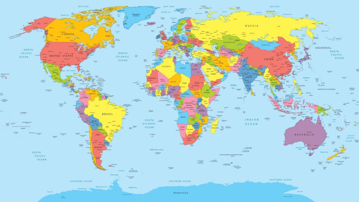
Le 20 novembre 2024, le monde entier se réunira pour célébrer le 25e anniversaire du GIS Day, un événement mondial qui met en lumière la puissance de la technologie des systèmes d'information géographique (SIG).
Organisé par Esri, leader mondial des solutions SIG et de cartographie, le GIS Day est l'occasion pour les professionnels, les étudiants et les passionnés de géographie d'explorer la manière dont cette technologie transforme les industries et résout les défis du monde réel.
Le thème de cette année, Mapping Minds, Shaping the World: 25 Years of GIS Excellence, résume l'impact profond que les SIG ont eu sur la révolution de notre compréhension du monde. Avec plus de 4 000 événements prévus dans le monde entier, des webinaires et ateliers aux présentations et activités interactives, le GIS Day 2024 promet d'être une vitrine dynamique des innovations qui stimulent la technologie géospatiale.
La puissance de l'intelligence géographique
Au fond, le GIS Day est bien plus qu'un simple événement : c'est un événement qui révolutionne la technologie géospatiale. Il s’agit d’un mouvement qui souligne à quel point l’intelligence géographique est essentielle pour résoudre certains des problèmes les plus urgents du monde. De la planification urbaine durable à l’atténuation du changement climatique, la technologie SIG offre les outils pour analyser les données dans le contexte de la localisation, permettant une prise de décision éclairée et de meilleurs résultats.
Jack Dangermond, président d’Esri et visionnaire à l’origine de la Journée SIG, revient sur ce parcours : « La Journée SIG est devenue une occasion importante pour les passionnés de cartographie et les scientifiques de la technologie géospatiale de se réunir pour partager leur travail significatif. Les défis auxquels nous sommes confrontés, de la planification urbaine durable au niveau local à la protection de la santé des océans à l’échelle mondiale, sont tous de nature géographique. Voir comment la communauté SIG adopte une approche géographique pour résoudre ces problèmes, tout en inspirant une nouvelle génération de professionnels, est ce qui rend cette journée vraiment spéciale. »
Une célébration collaborative et éducative
Le 25e anniversaire de la Journée SIG met l’accent sur l’esprit de collaboration qui définit la communauté géospatiale. Les événements de cette année mettront en lumière la manière dont la fusion de l’ingéniosité humaine et de l’innovation technologique aide les gens du monde entier à découvrir des modèles cachés, à promouvoir le développement durable et à prendre de meilleures décisions en utilisant des informations spatiales.
Les participants peuvent s’attendre à :
Des webinaires et des ateliers interactifs : des experts du secteur se plongeront dans les dernières applications des SIG, couvrant des sujets allant de la conservation de l’environnement à l’urbanisme et à la gestion des catastrophes.
Des exemples de réussite dans différents secteurs : des présentations et des études de cas révéleront comment les SIG sont appliqués dans divers secteurs, tels que la santé, les transports et la sécurité publique, mettant en valeur l’impact diversifié de cette technologie.
Des événements éducatifs et communautaires : des écoles, des universités et des communautés locales organiseront des événements visant à inspirer la prochaine génération de professionnels des SIG, des séances pratiques de création de cartes aux conférences en classe.
La composante éducative de l’événement ne peut être surestimée. Depuis sa création en 1999, la Journée des SIG a joué un rôle central dans la sensibilisation à l’importance de l’intelligence géographique. L’idée qui a commencé avec Ralph Nader, défenseur des consommateurs, qui a suggéré de consacrer une journée à montrer l’impact des SIG sur la vie quotidienne, est devenue une célébration mondiale. Au fil des ans, les utilisateurs ont organisé des milliers d’événements, des présentations scolaires aux projets de cartographie communautaire, diffusant des connaissances et inspirant de nouvelles applications de cette technologie transformatrice.
Des outils de cartographie aux solutions de problèmes mondiaux
Au cours des 25 dernières années, la technologie SIG est passée de simples outils de cartographie à des plateformes sophistiquées capables de gérer des analyses de données complexes sur plusieurs couches géographiques. Aujourd’hui, les SIG sont l’épine dorsale d’innombrables applications, de la gestion des ressources naturelles à l’optimisation des chaînes d’approvisionnement et à la réponse aux catastrophes naturelles.
Esri, fondée en 1969 à Redlands, en Californie, a été à l’avant-garde de cette évolution. Les logiciels de l’entreprise sont déployés dans des centaines de milliers d’organisations à travers le monde, allant des entreprises du Fortune 500 aux agences gouvernementales et aux organisations à but non lucratif. La portée mondiale d’Esri, avec des bureaux et des partenaires dans plus de 100 pays, reflète le besoin universel d’intelligence de localisation pour résoudre les défis les plus critiques du monde.
Cartographier un avenir durable
Alors que nous célébrons le 25e anniversaire de la Journée des SIG, il est clair que le rôle des SIG ne fera que continuer à prendre de l’importance. La capacité de la technologie à fournir des données en temps réel, à analyser des scénarios complexes et à présenter des informations visuellement en fait un outil essentiel pour planifier un avenir durable. Qu’il s’agisse de définir des stratégies de réduction des émissions de carbone ou de planifier des villes résilientes, les SIG offrent une approche géographique de la résolution de problèmes sans précédent.
L’importance des SIG va au-delà de la technologie elle-même. Il s’agit de favoriser une communauté de professionnels, d’éducateurs et de passionnés qui sont passionnés par l’utilisation de la géographie pour rendre le monde meilleur. La Journée des SIG 2024 n’est pas seulement une célébration des 25 dernières années, mais un appel à l’action pour la prochaine génération de penseurs géospatiaux.
Un héritage d’innovation et de collaboration
En réfléchissant à l’héritage de la Journée des SIG, la vision de Jack Dangermond d’un monde où la géographie joue un rôle central dans la prise de décision est devenue une réalité. La journée continue d’inspirer la collaboration et l’innovation, en réunissant des personnes d’horizons divers pour explorer comment la cartographie et l’analyse spatiale peuvent façonner notre avenir collectif.
À l’avenir, la technologie SIG est prête à relever des défis encore plus grands. Alors que les crises mondiales deviennent de plus en plus complexes et interconnectées, la capacité de cartographier et d’analyser les données géographiques sera essentielle pour créer des solutions à la fois efficaces et équitables.
Pour ceux qui sont curieux à propos des SIG ou qui sont des experts chevronnés dans le domaine, le 25e anniversaire de la Journée des SIG est un rappel du pouvoir de l’intelligence géographique. C'est l'occasion de voir jusqu'où la technologie est allée et d'imaginer où elle peut nous mener dans les 25 prochaines années et au-delà.
NJC.© Info GIS Day Esri
-------------------------------------------------------------------------------------------------------------------
26/08/24-English
Celebrating Mapping and 25 years of GIS Day
Map- ght
On November 20, 2024, the world will come together to celebrate the 25th anniversary of GIS Day, a global event that highlights the power of Geographic Information System (GIS) technology.
Organised by Esri, the global leader in GIS and mapping solutions, GIS Day is a moment for professionals, students, and geography enthusiasts to explore how this technology is transforming industries and solving real-world challenges.
This year’s theme, Mapping Minds, Shaping the World: 25 Years of GIS Excellence, encapsulates the profound impact that GIS has had in revolutionising our understanding of the world. With more than 4,000 events planned globally, from webinars and workshops to presentations and interactive activities, GIS Day 2024 promises to be a dynamic showcase of the innovations driving geospatial technology.
The Power of Geographic Intelligence
At its core, GIS Day is more than just an event; it’s a movement that underscores how geographic intelligence is integral to addressing some of the world’s most pressing issues. From sustainable urban planning to climate change mitigation, GIS technology offers the tools to analyse data in the context of location, enabling informed decision-making and better outcomes.
Jack Dangermond, President of Esri and the visionary behind GIS Day, reflects on the journey: “GIS Day has become a significant opportunity for mapping enthusiasts and geospatial technology scientists alike to come together to share their meaningful work. The challenges we face—from sustainable urban planning at the local level, to protecting ocean health on a global scale—are all geographic in nature. Seeing how the GIS community is taking a geographic approach to solving these issues, while inspiring a new generation of professionals, is what makes this day truly special.”
A Collaborative and Educational Celebration
GIS Day’s 25th anniversary focuses on the collaborative spirit that defines the geospatial community. This year’s events will highlight how the fusion of human ingenuity and technological innovation is helping people worldwide uncover hidden patterns, promote sustainable development, and make better decisions using spatial insights.
Participants can look forward to:
Interactive Webinars and Workshops: Industry experts will dive into the latest applications of GIS, covering topics from environmental conservation to urban planning and disaster management.
Success Stories Across Industries: Presentations and case studies will reveal how GIS is being applied in various sectors, such as healthcare, transportation, and public safety, showcasing the diverse impact of this technology.
Educational Outreach and Community Events: Schools, universities, and local communities will host events aimed at inspiring the next generation of GIS professionals, from hands-on map-making sessions to classroom talks.
The event’s educational component cannot be overstated. Since its inception in 1999, GIS Day has played a pivotal role in raising awareness about the importance of geographic intelligence. What began as an idea from consumer advocate Ralph Nader, who suggested dedicating a day to showcase how GIS impacts everyday life, has blossomed into a global celebration. Over the years, users have hosted thousands of events—from school presentations to community mapping projects—spreading knowledge and inspiring new applications of this transformative technology.
From Mapping Tools to Global Problem Solvers
Over the past 25 years, GIS technology has evolved from simple mapping tools into sophisticated platforms capable of handling complex data analysis across multiple layers of geography. Today, GIS is the backbone of countless applications, from managing natural resources to optimising supply chains and responding to natural disasters.
Esri, which was founded in 1969 in Redlands, California, has been at the forefront of this evolution. The company’s software is deployed in hundreds of thousands of organisations worldwide, ranging from Fortune 500 companies to government agencies and non-profits. Esri’s global reach, with offices and partners in over 100 countries, reflects the universal need for location intelligence in solving the world’s most critical challenges.
Mapping a Sustainable Tomorrow
As we celebrate the 25th anniversary of GIS Day, it’s clear that the role of GIS will only continue to grow in importance. The technology’s ability to provide real-time data, analyse complex scenarios, and present insights visually makes it a crucial tool in planning for a sustainable future. Whether it’s mapping out strategies for reducing carbon emissions or planning resilient cities, GIS offers a geographic approach to problem-solving that is unparalleled.
The significance of GIS extends beyond the technology itself. It’s about fostering a community of professionals, educators, and enthusiasts who are passionate about using geography to make the world a better place. GIS Day 2024 is not just a celebration of the past 25 years but a call to action for the next generation of geospatial thinkers.
A Legacy of Innovation and Collaboration
Reflecting on the legacy of GIS Day, Jack Dangermond’s vision of a world where geography plays a central role in decision-making has become a reality. The day continues to inspire collaboration and innovation, bringing together people from diverse backgrounds to explore how mapping and spatial analysis can shape our collective future.
Looking ahead, GIS technology is poised to tackle even bigger challenges. As global crises become increasingly complex and interlinked, the ability to map and analyse geographic data will be critical in creating solutions that are both effective and equitable.
For those who are curious about GIS or are seasoned experts in the field, GIS Day’s 25th anniversary is a reminder of the power of geographic intelligence. It’s a chance to see how far the technology has come and to imagine where it can take us in the next 25 years and beyond.
NJC.© Info GIS Day Esri
---------------------------------------------------------------------------------------------------------------
26/08/24-NL
Viering van Mapping en 25 jaar GIS Day
Map- ght
Op 20 november 2024 komt de wereld samen om de 25e verjaardag van GIS Day te vieren, een wereldwijd evenement dat de kracht van Geographic Information System (GIS)-technologie benadrukt.
Georganiseerd door Esri, de wereldleider in GIS- en mappingoplossingen, is GIS Day een moment voor professionals, studenten en geografie-enthousiastelingen om te ontdekken hoe deze technologie industrieën transformeert en echte uitdagingen oplost.
Het thema van dit jaar, Mapping Minds, Shaping the World: 25 Years of GIS Excellence, vat de diepgaande impact samen die GIS heeft gehad op het revolutioneren van ons begrip van de wereld. Met meer dan 4.000 evenementen wereldwijd gepland, van webinars en workshops tot presentaties en interactieve activiteiten, belooft GIS Day 2024 een dynamische showcase te worden van de innovaties die geospatiale technologie aandrijven.
De kracht van geografische intelligentie
In de kern is GIS Day meer dan alleen een evenement; het is een beweging die benadrukt hoe geografische intelligentie integraal is om enkele van 's werelds meest urgente problemen aan te pakken. Van duurzame stadsplanning tot het beperken van klimaatverandering, GIS-technologie biedt de tools om gegevens te analyseren in de context van locatie, wat geïnformeerde besluitvorming en betere resultaten mogelijk maakt.
Jack Dangermond, President van Esri en de visionair achter GIS Day, blikt terug op de reis: "GIS Day is een belangrijke kans geworden voor liefhebbers van kaarten en geospatiale technologie om samen te komen en hun zinvolle werk te delen. De uitdagingen waar we voor staan - van duurzame stadsplanning op lokaal niveau tot het beschermen van de gezondheid van de oceaan op wereldwijde schaal - zijn allemaal geografisch van aard. Zien hoe de GIS-gemeenschap een geografische benadering hanteert om deze problemen op te lossen, terwijl ze een nieuwe generatie professionals inspireert, is wat deze dag echt speciaal maakt."
Een collaboratieve en educatieve viering
De 25e verjaardag van GIS Day richt zich op de collaboratieve geest die de geospatiale gemeenschap definieert. De evenementen van dit jaar benadrukken hoe de combinatie van menselijke vindingrijkheid en technologische innovatie mensen wereldwijd helpt verborgen patronen te ontdekken, duurzame ontwikkeling te bevorderen en betere beslissingen te nemen met behulp van ruimtelijke inzichten.
Deelnemers kunnen uitkijken naar:
Interactieve webinars en workshops: experts uit de industrie duiken in de nieuwste toepassingen van GIS, waarbij onderwerpen worden behandeld van milieubehoud tot stadsplanning en rampenbeheer.
Succesverhalen in verschillende sectoren: presentaties en casestudies laten zien hoe GIS wordt toegepast in verschillende sectoren, zoals gezondheidszorg, transport en openbare veiligheid, en laten de uiteenlopende impact van deze technologie zien.
Educatieve outreach en gemeenschapsevenementen: scholen, universiteiten en lokale gemeenschappen organiseren evenementen die gericht zijn op het inspireren van de volgende generatie GIS-professionals, van praktische kaartsessies tot klassikale lezingen.
Het educatieve aspect van het evenement kan niet genoeg worden benadrukt. Sinds de oprichting in 1999 heeft GIS Day een cruciale rol gespeeld bij het vergroten van het bewustzijn over het belang van geografische intelligentie. Wat begon als een idee van consumentenvoorvechter Ralph Nader, die voorstelde om een dag te wijden aan het laten zien hoe GIS het dagelijks leven beïnvloedt, is uitgegroeid tot een wereldwijde viering. In de loop der jaren hebben gebruikers duizenden evenementen georganiseerd, van schoolpresentaties tot community mapping-projecten, om kennis te verspreiden en nieuwe toepassingen van deze transformatieve technologie te inspireren.
Van mappingtools tot wereldwijde probleemoplossers
De afgelopen 25 jaar is GIS-technologie geëvolueerd van eenvoudige mappingtools naar geavanceerde platforms die complexe data-analyses over meerdere lagen van de geografie aankunnen. Tegenwoordig is GIS de ruggengraat van talloze toepassingen, van het beheren van natuurlijke hulpbronnen tot het optimaliseren van toeleveringsketens en het reageren op natuurrampen.
Esri, dat in 1969 werd opgericht in Redlands, Californië, is de voorloper van deze evolutie. De software van het bedrijf wordt wereldwijd ingezet in honderdduizenden organisaties, variërend van Fortune 500-bedrijven tot overheidsinstanties en non-profitorganisaties. Esri's wereldwijde bereik, met kantoren en partners in meer dan 100 landen, weerspiegelt de universele behoefte aan locatie-intelligentie bij het oplossen van 's werelds meest kritieke uitdagingen.
Een duurzame toekomst in kaart brengen
Nu we de 25e verjaardag van GIS Day vieren, is het duidelijk dat de rol van GIS alleen maar belangrijker zal worden. Het vermogen van de technologie om realtime gegevens te leveren, complexe scenario's te analyseren en inzichten visueel te presenteren, maakt het een cruciaal hulpmiddel bij het plannen van een duurzame toekomst. Of het nu gaat om het in kaart brengen van strategieën voor het verminderen van koolstofemissies of het plannen van veerkrachtige steden, GIS biedt een geografische benadering van probleemoplossing die ongeëvenaard is.
De betekenis van GIS reikt verder dan de technologie zelf. Het gaat om het bevorderen van een community van professionals, docenten en enthousiastelingen die gepassioneerd zijn over het gebruik van geografie om de wereld een betere plek te maken. GIS Day 2024 is niet alleen een viering van de afgelopen 25 jaar, maar ook een oproep tot actie voor de volgende generatie geospatiale denkers.
Een erfenis van innovatie en samenwerking
Jack Dangermond reflecteert op de erfenis van GIS Day en zijn visie op een wereld waarin geografie een centrale rol speelt in besluitvorming. De dag blijft samenwerking en innovatie inspireren en brengt mensen met verschillende achtergronden samen om te onderzoeken hoe kartering en ruimtelijke analyse onze gezamenlijke toekomst kunnen vormgeven.
Vooruitkijkend is GIS-technologie klaar om nog grotere uitdagingen aan te pakken. Nu wereldwijde crises steeds complexer en met elkaar verweven worden, zal het vermogen om geografische gegevens in kaart te brengen en te analyseren van cruciaal belang zijn bij het creëren van oplossingen die zowel effectief als billijk zijn.
Voor degenen die nieuwsgierig zijn naar GIS of doorgewinterde experts zijn op dit gebied, is de 25e verjaardag van GIS Day een herinnering aan de kracht van geografische intelligentie. Het is een kans om te zien hoe ver de technologie is gekomen en om te bedenken waar het ons de komende 25 jaar en verder kan brengen.
NJC.© Info GIS Day Esri
-------------------------------------------------------------------------------------------------------------------
Date de dernière mise à jour : 23/08/2024